SITUATIONAL AWARENESS
WHEN IT MATTERS MOST
Sentinel is a multi-client situational-awareness platform for disaster response and civil protection. It fuses live drone video, AI analytics, hazard data, and TAK feeds into one real-time map — from the operations centre to the field.
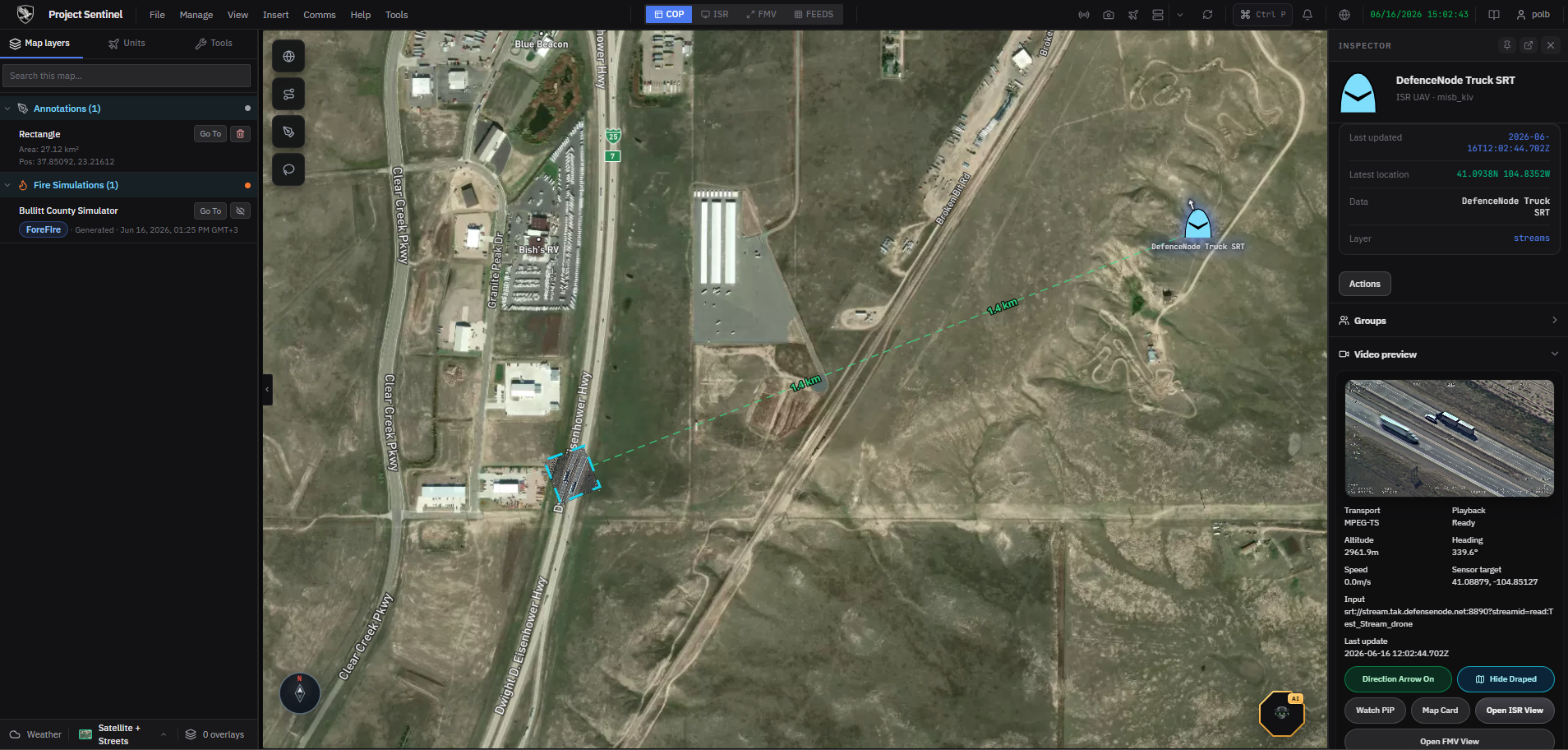
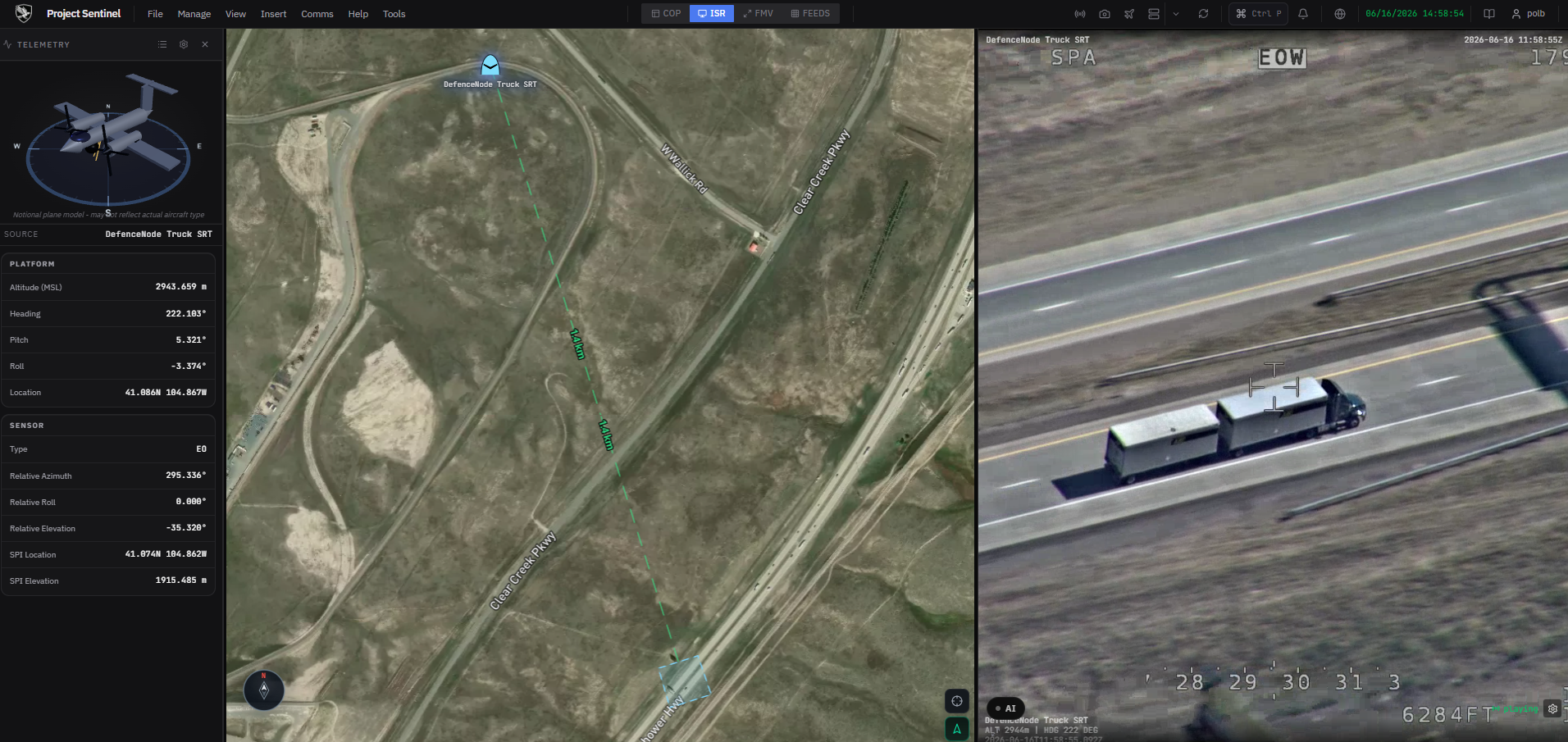
Tactical map dashboard
A live map that fuses every feed into one operating picture. Switch between master, side-by-side, and focused modes to run a single incident or compare sectors side by side.
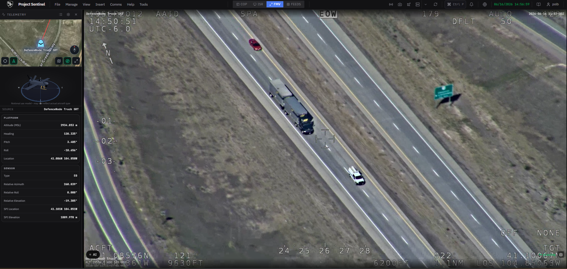
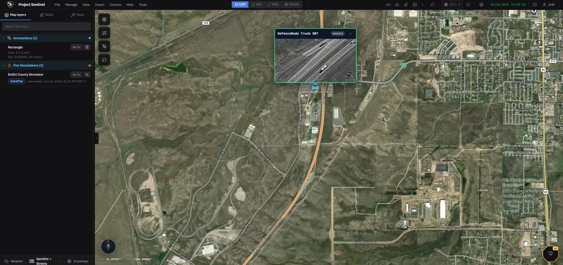
Live drone FMV with KLV telemetry
Ingest live video from drones and cameras, align each frame with its MISB/KLV metadata, and put the sensor footprint straight on the map — RTSP, SRT, HLS, and WebRTC.
Automated detection & area analysis
On-stream AI flags objects of interest and analyses areas without an operator watching every frame. CPU-first by design, with optional GPU acceleration.
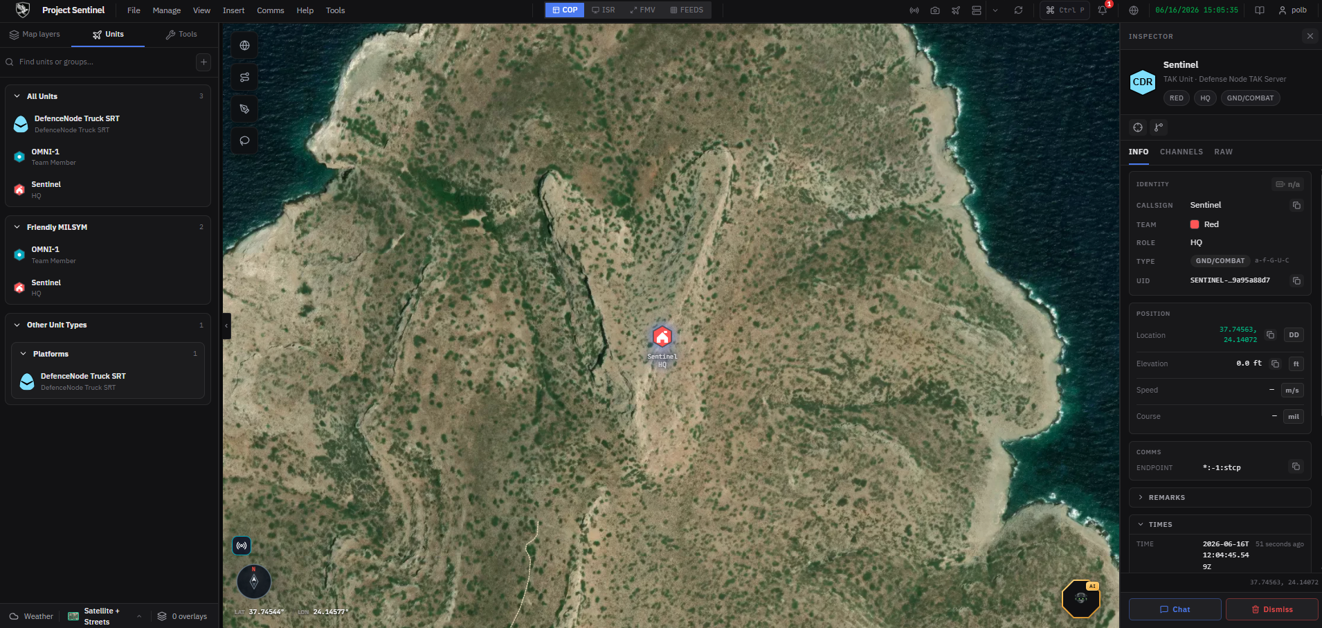
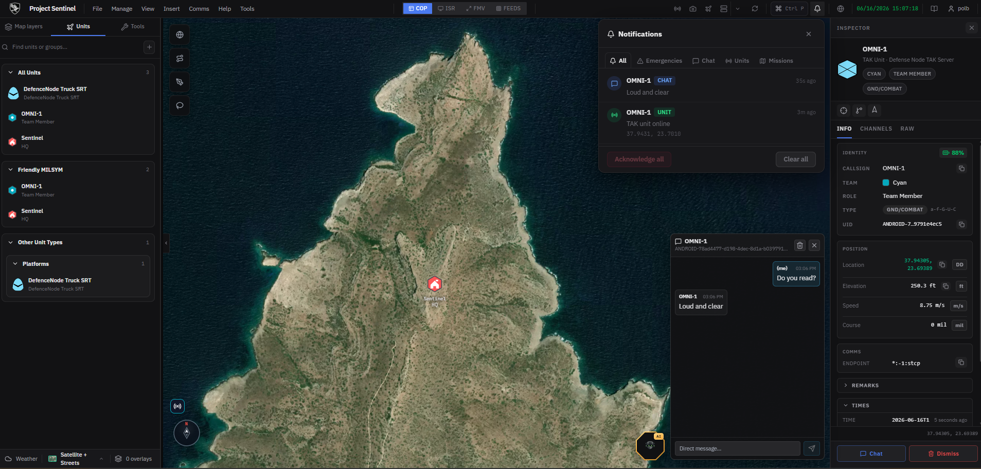
Native TAK integration
Sentinel speaks Cursor-on-Target. Share units, tracks, and detections with ATAK/WinTAK teams in the field and pull their picture back in — bidirectionally.
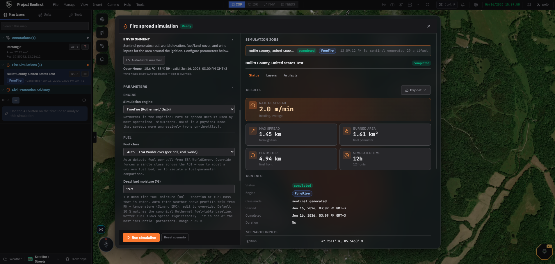
Hazard overlays & fire-spread simulation
Pull authoritative hazard data from dozens of providers and model how a wildfire will spread, so commanders can stage resources ahead of the front.
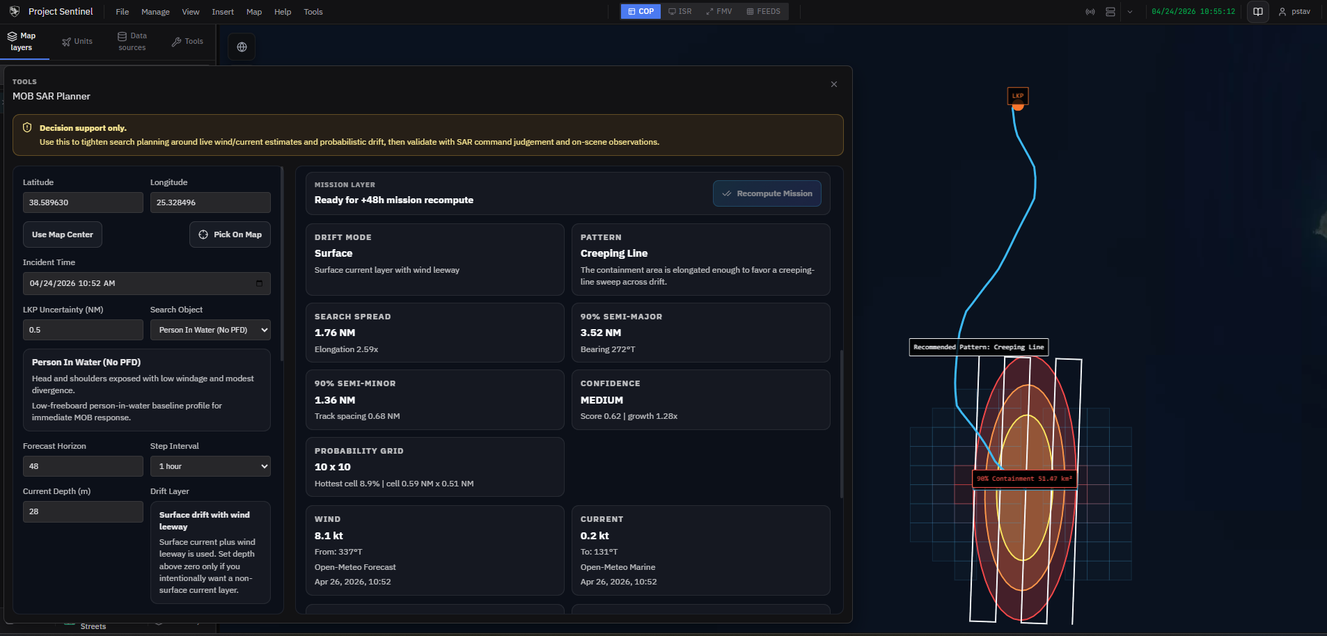
SAR pattern planning
Generate standard search-and-rescue patterns over the area of operations and push them to field units as routes — coordinating air and ground assets from one console.
BUILT FOR THE FIELD
From the operations centre to a tablet in a degraded network.
Multi-client
Operator web UI, admin console, and an Android field/commander app — one backend, three surfaces.
Realtime by default
A SignalR hub fans SOS alerts, telemetry, orders, and TAK events to every connected client over a Valkey event bus.
AI workers
Object-detection and area-analysis workers run CPU-first, scaling to GPU when available — no config required.
Field-ready
Android client with offline handling, GPS, commander panels, and SOS — built for connectivity-degraded environments.
FROM THE CONSOLE
GOVERNED BY DEFENCE NODE
Every Sentinel deployment reads its tier, features, and caps from the Defence Node control plane — enforced locally, signed with Ed25519, and verifiable even fully air-gapped. Customers can use their entitlements, never edit them.
REQUEST ACCESS